
GPS in Action
You are familiar with the little blue dot that identifies your precise location and apps that help you navigate to your intended destination. But did you know that GPS is an integral part of these and hundreds of other applications that improve our day-to-day lives, and even help save our lives?
Learn more below:
Accelerating Emergency Response Times
Featuring GPSIA Member Garmin
Garmin inReach-enabled devices locate and assist users who are experiencing emergencies. GPS signals are especially valuable for first responders who are trying to find people in remote locations or when Wi-Fi isn't available. (Watch video here!)


Photo: Garmin
Improving Rail Safety through Positive Train
Control Systems
Featuring The Association of American Railroads
Trains equipped with GPS technology prevent derailments and collisions. In the event of movement violations, positive train control-equipped trains will be stopped to reduce the impacts of human error.

Video: AAR
Delivering Accurate Earthquake Warnings
Featuring ShakeAlert
Shake Alert uses GPS and other sensors to warn the public in advance when and where earthquakes will strike so people may safely seek shelter.

Video: UC Berkeley
Improving Weather
Forecasts
Featuring NASA and NOAA
GPS Technology can help researchers better forecast weather using Global Navigation Satellite Systems (GNSS) and a technique called radio occultation.

Video: NASA
GPS-Enabled Air Navigation
Featuring GPSIA Member Garmin
GPS-equipped aircraft navigate more efficiently and enable pilots to relay their position to air traffic control and other aircraft. The benefits? Safely reducing aircraft separation increases flight capacity, reduces fuel consumption, and optimizes flight routes. (Watch the video here!)


Photo: Garmin
Portable Air Navigation
Featuring GPSIA Member Garmin
GNSS receivers are used in Air Navigation Technology to provide General Aviators accurate positioning in real time, creating more efficiency and control, and determining the quickest route. (Watch video here!)


Photo: Garmin
Micromobility Solves the "Last Mile"
Featuring National League of Cities
Scooters, bikes, and other micro vehicles are convenient and safe with the help of GPS. Accompanying apps locate the nearest vehicle, calculate the cost of users to rent the vehicles for short distances, and improve the rider's safety using GPS technology.
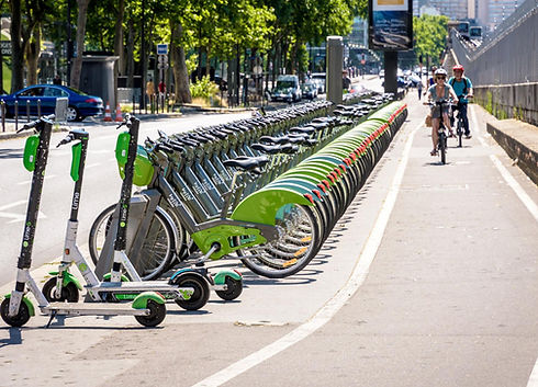

Photo: City of Redwood, CA
Keeping a Watchful Eye on Your Vehicle
Featuring GPSIA Member Garmin
Dash Cams improve driver safety and can provide a record of incidents on the road and while vehicles are parked. GPS-enabled technology registers time and location, which can be vital in pinpointing when and where an incident occurred.


Photo: Garmin
Food Security through Precision
Agriculture
Featuring GPSIA Member Deere & Co.
Precision Agriculture enabled by GPS increases the efficiency of farming, saving farmers time and reducing costs for water, plantings/seeds, and pesticide and herbicide applications.

21st Century Ranching
Featuring Kansas City University Radio
GPS technology allows Ranchers to save time and decrease costs for installing and repairing fences. Collars equipped with GPS help Ranchers locate animals, keep them safe, and remotely monitor their locations.


Photo: Celia Llopis-Jepsen
Smart Fishing
Featuring GPSIA Member Garmin
Sonar and GPS technology makes finding fish more efficient by tracking and recording locations where fish are swimming.


Photo: Garmin
Surveyors Make
Infrastructure a Reality
Featuring GPSIA Member Trimble
Advanced surveying technologies use GPS to help safely and efficiently place and construct roads, buildings, power supplies, and waterways, down to centimeters-level accuracy.

Heading 6
Photo: Wix
Today and the Future: Digital Construction
Featuring GPSIA Member Trimble
GNSS receivers are used in Construction Technology to provide accurate positioning in real time, creating more efficiency and control when using heavy equipment and accelerating project completion.

Land Management through Precision Forestry
and Logging
Featuring GPSIA Member Deere & Co.
GPS technology can locate treelines and track the progress of logging, allowing operators to log only where necessary and permitted.

GPS in Financial Institutions
Featuring Brickhouse Security
GPS tracking devices can be used in banking institutions to protect assets and help track down stolen items.
Atomic clocks on board the GPS satellites also synchronize nearly every financial transaction completed worldwide.

Photo: Etienne Martin
Humanitarian
Demining Saves Lives
Landmines pose a major threat to the lives of civilians. GPS-enabled technology can locate the position of these landmines from a distance to ensure the safety of civilians.

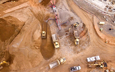
Photo: Shane McLendon
GPS-Enhanced Archaeology
GPS technology is used by archaeologists record and collect data, map sites, and even predict the location of archaeological sites.
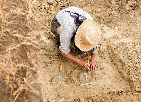
Photo: Stevica Mrdja
Tracking
Endangered Species
Featuring BBC and Marwell Wildlife
GPS collars are used to help endangered species by tracking and monitoring their movements to discover ways to improve their lives and avoid extinction.

Photo: Marwell Wildlife

Safe, Fun
Off-Roading
Featuring GPSIA Member Garmin
GNSS receivers "listen" for global satellite signals, and turn this information into a safe route so drivers can enjoy their ride. (Watch video here!)

